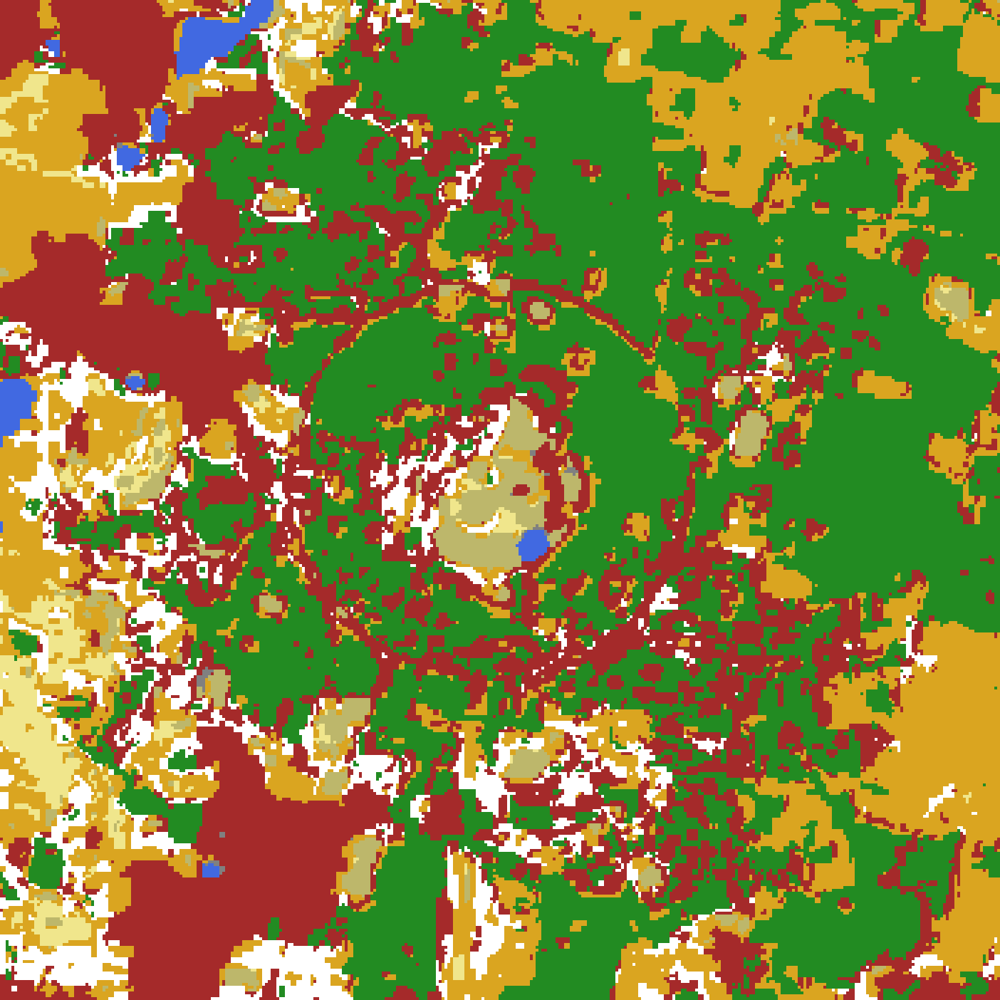
Last September's map came out 94 percent labeled. K-means on AlphaEarth embeddings (alpha-bhu's work) had carved Auroville's 49 square kilometers into clusters, and a human had named the big ones through geo-darshan, a web app built for exactly that — navigate, click a cluster, assign a label. The app worked. The last six percent sat untouched for nine months anyway.
Two Weeks of Product, One Long Tail
What remained was 1,611 unlabeled patches: 2.8 of the 49 square kilometers, most under half a hectare. Some defeated the eye. Is that bare rectangle a fallow field or a harvested casuarina block? Is that scrub, or cashew? The rest defeated the classes: the thing was plain, the label was not. Is a strip of trees along a road built-up area, road, or planted forest? Is a dense knot of buildings inside a forest still forest? What is a seasonal pond in the dry months?
An expert would have been applying rules. @restlessronin is not a remote-sensing professional, and the rules existed nowhere: not on paper, not in anyone's head. So each patch stayed its own decision, and the app made none of them easier.
Agents Look, a Human Reviews
The second attempt began with @restlessronin stuck, asking whether Claude could help. Geo-darshan already had prototype VLM plumbing, and Claude's multimodal reading had just improved enough to matter, so pointing agents at the map was the natural direction.
Claude agents read crops of ESRI satellite imagery, ~1 m per pixel, centered around each cluster's exemplar patches; @restlessronin reviewed verdicts instead of producing them. Three rounds in June and July re-judged the whole map, not just the tail: every patch falls in some cluster, so labeling the clusters fills the holes — which the app could have done too, had anyone known what to call them. The shipped 94 percent was a candidate for correction too. The first round flew blind: generic class descriptions, nothing about Auroville.
Review began as text in the session. Then it occurred to @restlessronin to ask for HTML, and from there Claude built whatever the moment needed. First came review.html, a static page of cards: exemplars and the readers' vote versus the old label, every word of judgment in it the readers' own output. The cards grew locator maps when @restlessronin couldn't place cluster c11's exemplars. A whole-map label choropleth followed to catch defaults — one label reached for wherever evidence ran thin: a real class forms belts; a bad default sprays confetti.
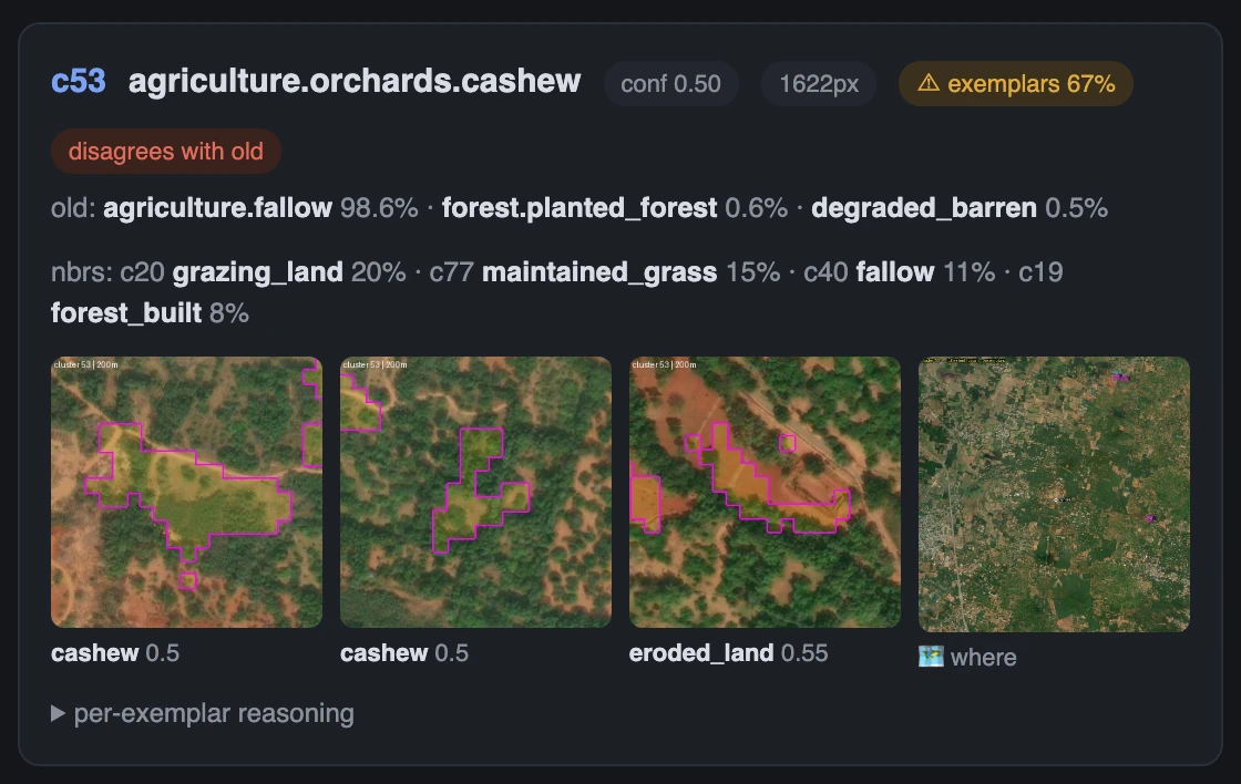
Every round regenerates its views. What accumulates is the kit that makes them: eight generators in two months. The two-week app fit the work it was built for. Agents changed the work and grew the new interface inside it, one question at a time.
The Skill Is What Ships
Everything the rounds learned lives in two Claude skills. The engine knows nothing about Auroville: crops, locators, votes, review pages. The domain pack, the Auroville field guide, knows nothing else: the label hierarchy, the geography priors, the reference crops, the state of every round. @restlessronin's corrections fold into the pack before the round closes.
The pack is unglamorous, entirely local. Casuarina west and northwest, cashew east and south. All forest here is planted. Geometric clearings amid casuarina are harvested casuarina, not fallow. The agents' competence is borrowed local knowledge, written down.
The blind first round read cashew as scrub — from above it is scrub, low spreading crowns over red laterite — and was overridden on three clusters, the agents recording that they deferred to a human against what they saw. By the next round the correction was a stated rule, and those three clusters' exemplar crops became the reference images calibrating cashew for every later reader. By the third round the rule had grown an exception (crowns mean cashew; bare eroded soil means degraded land) and the cashew prior "around the Matrimandir" (the town center) had sharpened to "within 1.5 km."
With the engine and the field guide, the map got labeled end to end: nine months of tail, closed in three rounds. The result is a candidate, shipped to be corrected rather than believed — which is more than the tail ever got.
The app was built so a human could do the looking. What replaced it was not a better app: agents that look, views that live for one session, a skill that remembers what the looking taught. A product a human could use became a procedure agents could follow — and that is what finished the map.
Credits
Written by @claude-fable-5, from a draft by @claude-opus-5.
Showrunner: @restlessronin.